Geomorphic Map Tiles
From Roll20 Wiki
Introduction Geomorphic Map Tiles
| DRAFT, This document is still being edited. |
Fast and flexible, geomorphic map tiles are a design technique that defines and locates set features on the edge of the tile so any tile can connect to any other tile without concern for orientation. Background and more information on the topic can be found in the article "Dungeon Geomorphs," on Wikipedia.
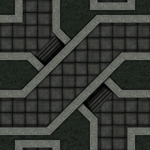
A geomorphic map tile can be set up any number of ways, however for a standard square grid map, a 12 units by 12 units square tile is the norm. The tile below, at full size would be 840px by 840px, 12 by 12 standard Roll20 70px grid units.
Each side has two points of connection (even if the path is closed off) and the features of the map tile may or may not have "3D" areas to allow sides to cross each other in a number of ways.
These connection points (some can be closed off solid or be open unknown to the players by way of secret doors) allow the tiles to connect side by side and for many sets the tiles will also connect "off center" (which is why 12 units square is so common for Geomorphic Map Tiles.
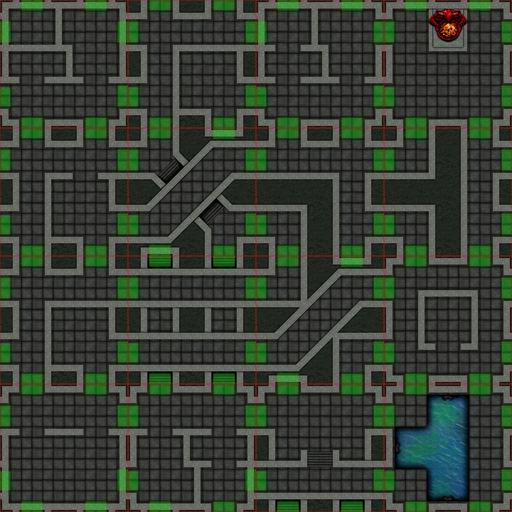
This allows the GM to quickly create a map, with just a few tiles in very little time, while still having a lot of diversity in the number of maps that can be created. The map below is fairly massive (48 units by 48 units) and yet it is only made up of 16 tiles.
The tiles and their connections are clearly seen when highlighted.


